16.03.2026, 13:28
Niantic Utilizes Pokémon Go Data to Enhance Delivery Robot Navigation
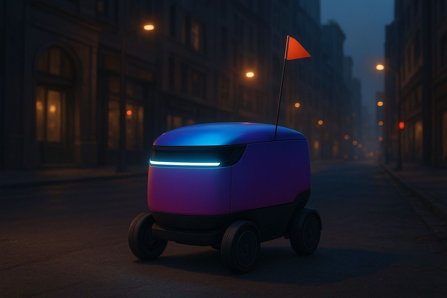
Niantic is leveraging augmented reality data from Pokémon Go to assist in training delivery robots for urban environments.
Niantic, the company behind Pokémon Go, is now employing the augmented reality data generated by players to improve the navigation capabilities of delivery robots. Rebranded as Niantic Spatial, the organization has partnered with the robotics startup Coco, which operates a fleet of 1,000 compact delivery vehicles designed for urban settings. These robots are trained to navigate busy streets much like how a real-life Pikachu would traverse the world. Although Niantic's popular titles, including Pokémon Go, Pikmin Bloom, and Monster Hunter Now, are now under the ownership of Scopely, Niantic retains the extensive database of AR data collected over the years. This includes millions of video scans submitted by users, which are carefully recorded at specific real-world locations recognized in the game, such as PokéStops or Gym sites, showcasing local art or notable buildings. It's important to clarify that this data collection is not done covertly; players actively upload the scans. Niantic Spatial is openly vocal about its requirement for real-world data to create an augmented reality map that will play a crucial role in a future where augmented reality technology aids navigation for both pedestrians and vehicles, including robotic pizza delivery systems. Brian McClendon, the CTO of Niantic Spatial, shared insights with MIT Technology Review, stating, "Everyone believed that AR was the next big thing, expecting AR glasses to take off. However, robots have emerged as a primary focus." He elaborated on the challenges of urban navigation, describing how the dense clustering of buildings can severely disrupt GPS accuracy. "In urban canyons, GPS is notoriously unreliable," he explained. "The blue dot on your smartphone can often mislead you by as much as 50 meters, placing you on a different block entirely." Niantic Spatial aims to utilize its extensive real-world data to help robots like those from Coco to navigate autonomously without depending on unreliable GPS signals. John Hanke, the founder and CEO, remarked, "Interestingly, the challenge of getting Pikachu to move realistically mirrors the challenge of ensuring Coco's robots can safely and accurately traverse their surroundings." The company claims to possess access to a staggering 30 billion images from urban environments, though it remains unclear if this figure refers to individual frames from video scans. Regardless, this wealth of data provides Coco’s robots a robust foundation for learning to navigate cities like Los Angeles, Chicago, Jersey City, Miami, and Helsinki. Hanke concluded by emphasizing the necessity for robots to develop a spatial awareness akin to that of humans, stating, "For robots to integrate seamlessly into urban environments without causing disruptions, they must possess a comparable understanding of their surroundings. We can assist them in pinpointing their exact location, even after being moved or jostled." As this innovative approach unfolds, the effectiveness of these advancements remains to be seen.